LiDAR Photo saves a 3D depth map with every picture. One tap on site, and the whole room is yours to
measure — walls, windows, doors, surfaces — today, tomorrow, or six months from now. And it's ready for your
AI assistant too.
REQ. — iPhone Pro model with LiDAR (iPhone 12 Pro or later), latest software update.
Accuracy±1–2 cmtypical, up to 5 m
Capture1 tapfor a whole room
Storage100%on your iPhone, no cloud
Output1 PDFreport per site visit
Sheet 02 — The real app
Not a concept. Screens from a real site visit.
Captured on an iPhone Pro, during an actual visit. People and addresses are blurred.
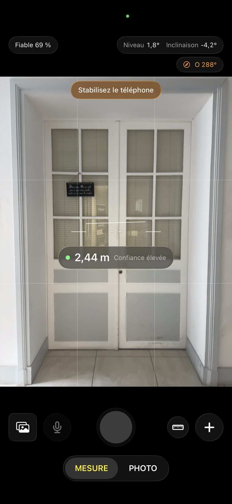
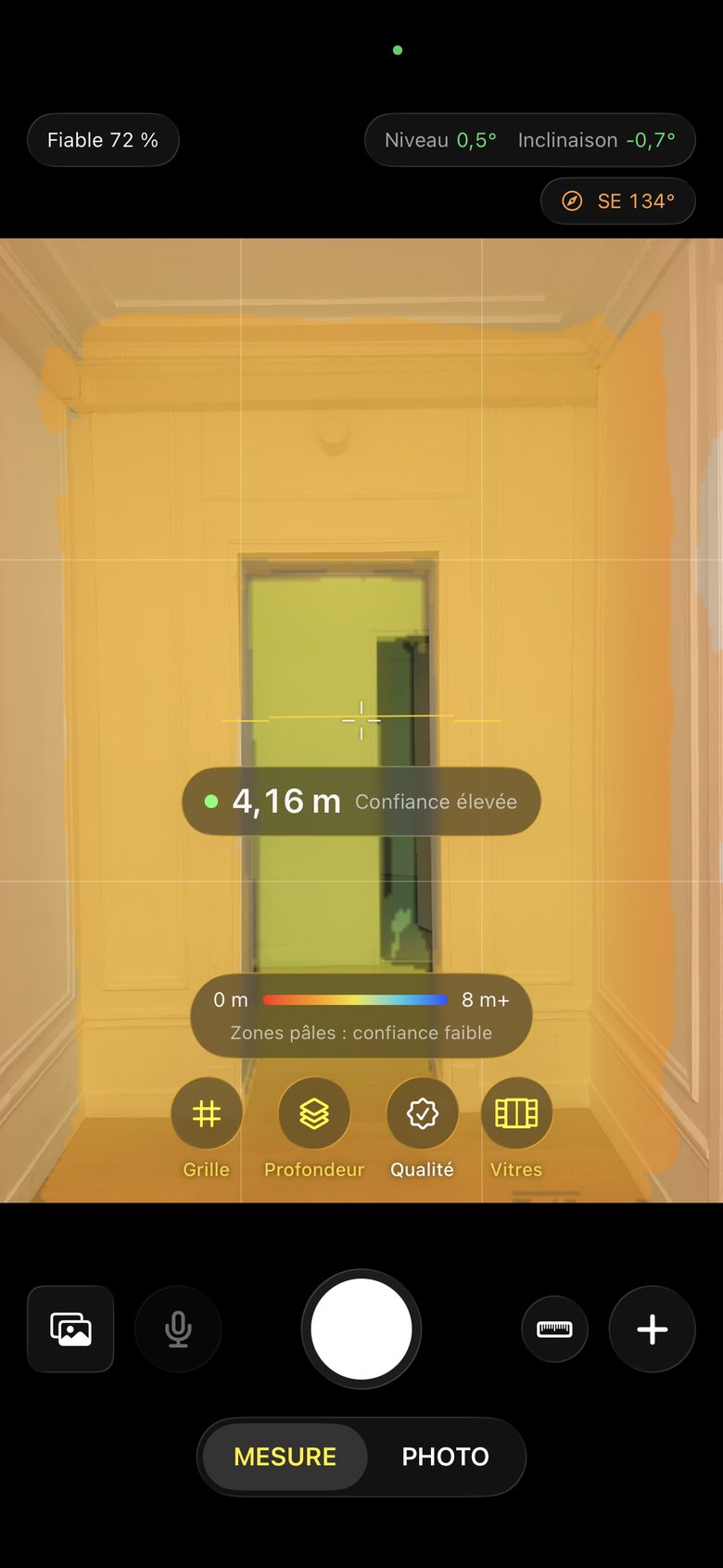
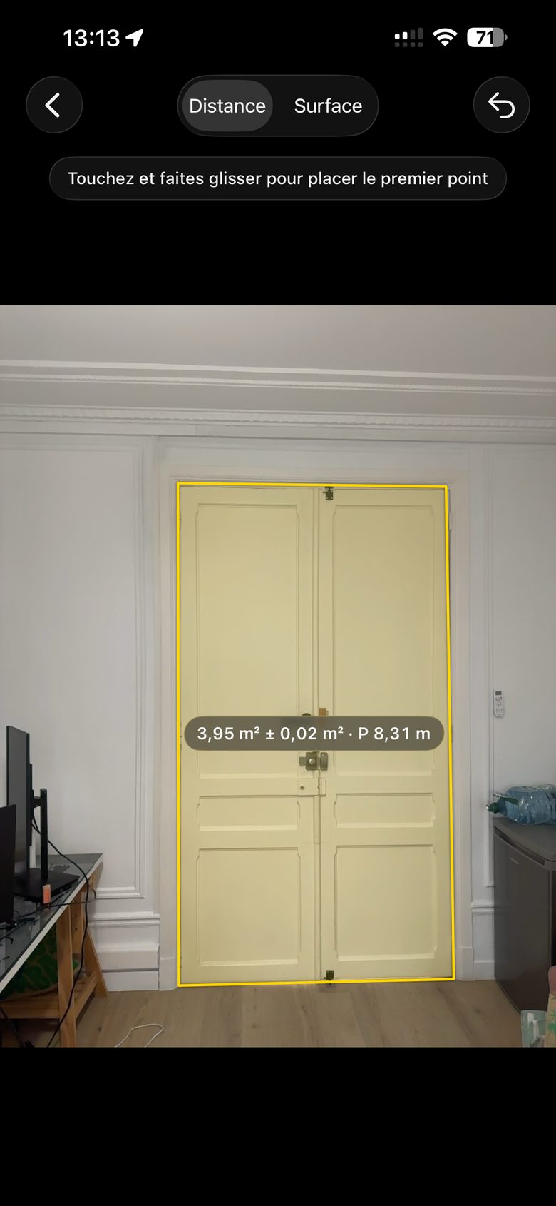
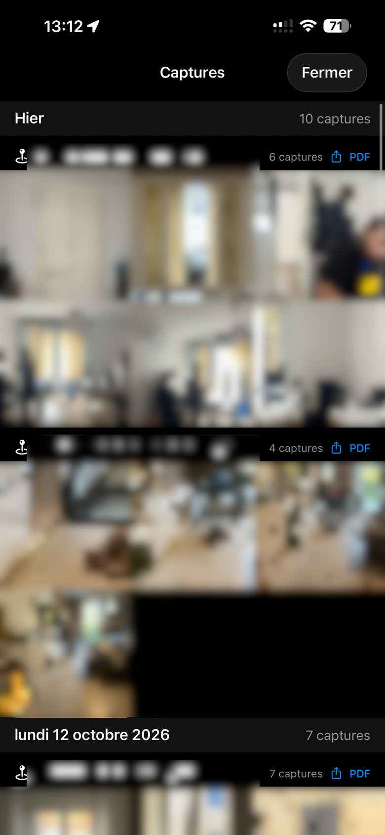
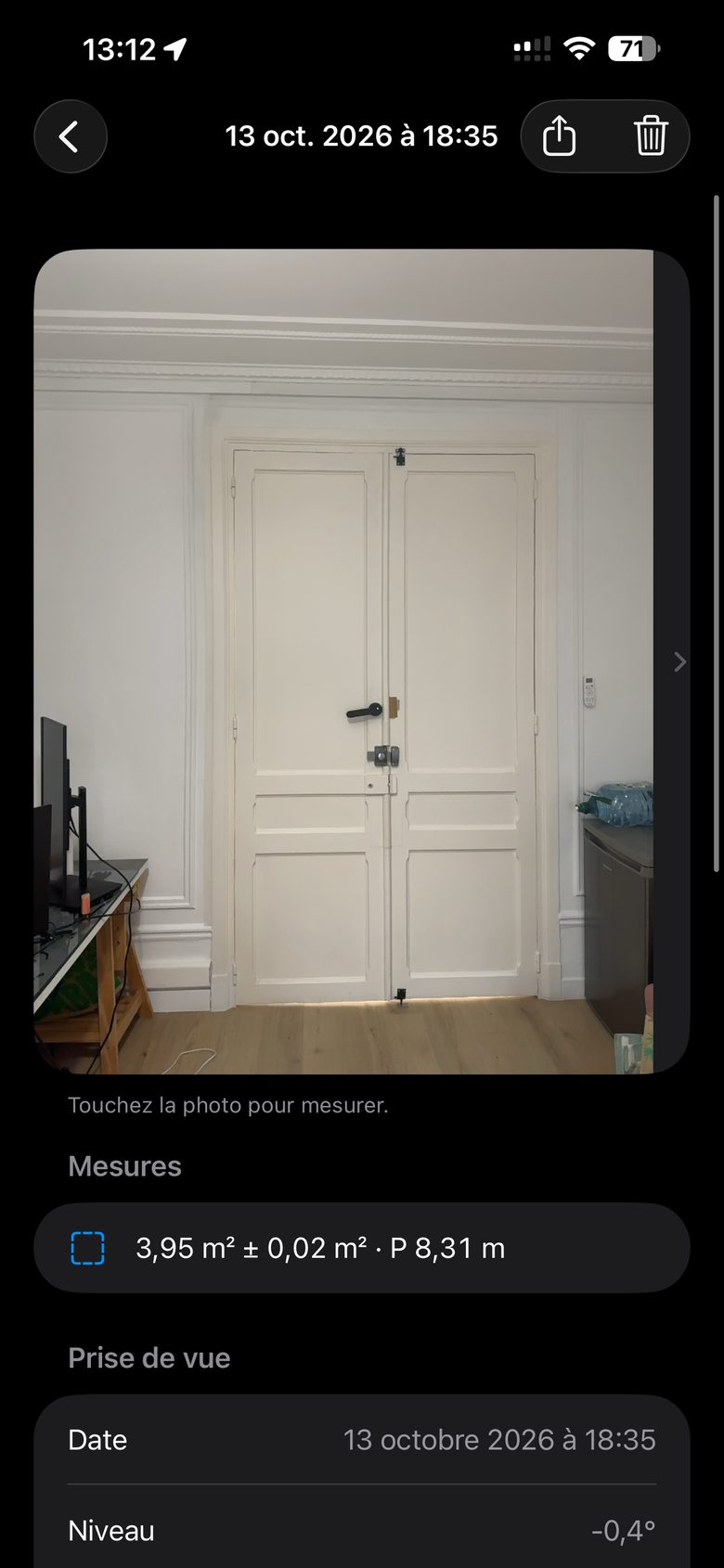
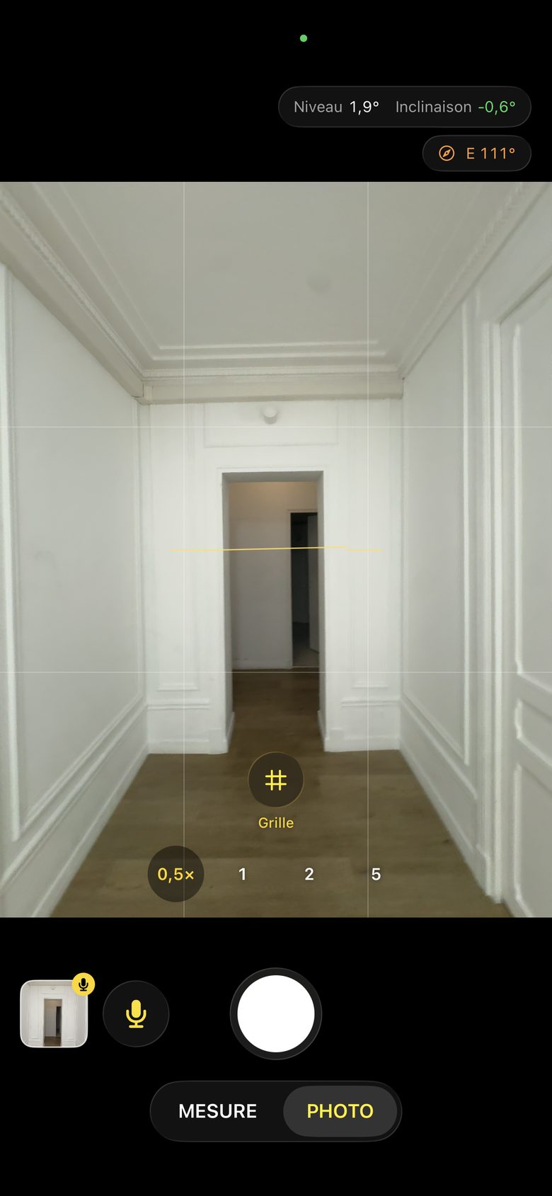
Fig. A — Live distance, 2.44 mFig. B — What the LiDAR seesFig. C — Surface on the photo, 3.95 m²Fig. D — Gallery by day and placeFig. E — Capture and its measurementsFig. F — Photo mode, 0.5× to 5×
Sheet 03 — Why it changes your site visits
Never go back to a site because you forgot one measurement.
A regular photo shows the room. A LiDAR Photo remembers its size. Shoot everything quickly on site,
then measure calmly from your desk — as many times as you need.
Fig. 02 — Measure on the photoElevation
Measure on the photo
Your photos keep their dimensions. Forever.
Open any capture from your gallery, place two points, get a distance. A magnifier follows your finger so you
land exactly on the corner. Every result shows its uncertainty, so you always know how far to trust it.
Distances and surfaces with perimeter
Precise corner placement with a magnifier
Measurements saved inside the capture
Fig. 03 — Live measure, world-anchoredIsometric
Live measure
A tape measure that never runs out.
Tap “+” on one end, walk to the other, tap again. Points stay anchored in the room, so the object doesn't
have to fit in the frame — measure a whole wall, a corridor, an opening. Then take the photo: the
measurements are saved with it.
Points anchored in 3D space, not on the screen
Distances and multi-corner surfaces
Numbered list always visible while you aim
Fig. 04 — Voice note attached to a photoOffline
Voice notes
Say it once. Find it attached to the right photo.
Hold the mic button and describe what you see. The note is transcribed right on your iPhone, works
offline, and keeps the original audio — so a technical word misheard is never lost. Prefer typing? A short tap
opens the keyboard.
On-device transcription, nothing uploaded
Original recording kept with the photo
Edit the text anytime in the gallery
Fig. 05 — Report and annotated photoA4 · JPEG
Share
From site visit to clean report, in one tap.
Every place you visit gets its own PDF report: address, date, every photo with its measurements drawn on
it, directions and notes. Or send a single annotated photo by email, Messages or WhatsApp — anyone can open
it, no app needed.
A4 PDF report per place and per day
Annotated photos with measurements and caption
Full LiDAR file for your archive — or your AI assistant
Fig. 06 — Gallery, by day and by placeAuto
Organized for you
Two sites in one day? Already sorted.
Captures are grouped by day, then by place, and titled with the street address — automatically. Your
professional photos live in LiDAR Photo, never mixed with your personal camera roll.
Grouped by day and by address, zero effort
Compass direction saved with each photo
Built-in photo mode from 0.5× to 5× for everything else
Sheet 04 — AI-ready
A photo that speaks. To you, and to your AI.
A normal photo leaves an AI guessing sizes from pixels. A LiDAR Photo capture hands it the facts: the picture,
a depth map aligned with it, the camera's calibration and position, the phone's tilt, the compass heading, the
location, your measurements and your notes — in a documented, open format.
Share the full capture with the AI assistant you already use, and ask real questions: “Will a 2 m radiator
fit under this window?”, “How much paint for this wall?”, “List everything you can see in
this boiler room.” It works from measured geometry, not guesswork.
Photo + depth + calibration + orientation in one capture
Measurements and notes included, in readable JSON
Documented format, ready for your own scripts and tools
Fig. 07 — One capture, three layersOpen format
Sheet 05 — And much more
Built to get it right the first time.
Everything you need to trust a measurement — before you even press the shutter.
F-01
See what the LiDAR sees
A live depth map and a reliability score show instantly whether the scene is well captured.
F-02
Glass and mirror warning
Windows and mirrors fool every depth sensor. LiDAR Photo detects them and tells you before you measure.
F-03
Artificial horizon
A level that shows both tilt and roll, turning yellow with a gentle tap when your shot is perfectly straight.
F-04
Surfaces and perimeters
Place as many corners as you need. Area and perimeter come with their uncertainty, live or on the photo.
F-05
Compass direction
Know which façade you photographed: the true heading is saved with every capture, even with the phone upright.
F-06
Works offline
Basements, plant rooms, new builds without network: capture, measure and dictate without any connection.
F-07
Open file format
Each capture keeps the photo, raw depth and documented metadata — readable by your AI assistant or your own tools.
F-08
Honest numbers
Every distance and area shows its margin of error. Checked against a laser distance meter up to 6 m.
F-09
A familiar camera layout
Clear glass controls, one shutter, nothing to learn. If you can take a photo, you can measure a building.
Sheet 06 — How it works
Three steps. That's the whole learning curve.
Capture
Aim, check the reliability score, press the shutter. Add a voice note if something is worth remembering.
Measure
Live with “+” while you're there, or later on the photo, from your desk, as many times as you like.
Share
Send an annotated photo, the PDF report of the visit, or the full capture to your AI assistant.
Sheet 07 — Made for the field
For everyone who measures for a living.
If your job starts with a site visit, LiDAR Photo saves you the second one.
Energy auditorsBuilding surveyorsArchitectsGeneral contractorsWindow and door installersHVAC and plumbingElectriciansReal-estate agentsInsurance adjustersProperty and facility managersInterior designersFlooring and painting
Private by design
Your sites stay on your iPhone.
Client homes, plans, technical rooms: what you capture is sensitive. LiDAR Photo has no account, no cloud, no
tracking. Nothing leaves your phone unless you decide to share it.
iPhone Pro and Pro Max models with a LiDAR scanner, from iPhone 12 Pro onward, with the latest software update.
Measuring is not possible on iPhone models without LiDAR.
How accurate is it?
Typically within 1 to 2 cm up to about 5 m on matte, well-lit surfaces, checked against a laser distance
meter. Glass, mirrors, very dark or shiny surfaces and longer distances reduce accuracy — the app warns you and
shows the uncertainty of every measurement. Measurements are indicative: where precision is critical,
confirm with a dedicated instrument.
Do I need an internet connection?
No. Capturing, measuring and dictating all work offline. A connection is only used to show the street address
of a place, and once to download the speech model the first time you dictate.
Can I use my captures with an AI assistant?
Yes. Share the full capture (Share › Full LiDAR capture) with an AI assistant that accepts files. Along with
the photo, it receives the depth map, the camera calibration and orientation, the location, your measurements
and your notes, in a documented format, so it can reason about real distances instead of guessing from pixels.
What the assistant does with the file depends on that service and its own privacy rules.
Is the app available in English?
The screens on this page show the current French interface. An English version is planned for the launch.
Where are my photos stored?
In the app's own gallery, on your iPhone, organized by day and place. They also appear in the Files app,
under On My iPhone › LiDAR Photo, so you can copy them to iCloud Drive or a computer.
When can I get it?
LiDAR Photo is coming soon. Want to be told when it's out? Send a quick email.
One visit. Every measurement.
Turn your iPhone Pro into the most patient surveyor you've ever worked with.
 LiDAR Photo